
Simanaitis Says
On cars, old, new and future; science & technology; vintage airplanes, computer flight simulation of them; Sherlockiana; our English language; travel; and other stuff
TOURING TUDOR ENGLAND—WITH PROFESSOR EVA TAYLOR AND GOOGLE MAPS PART 2
WHAT FUN EXPLORING the British Isles with maps dating from 1627! Well, yes, 20th-century Tudor authority Professor Eva G.R. Taylor helps too. And so do 21st-century Google Maps. Here in Part 2, we visit Somersetshire and see where it leads us.
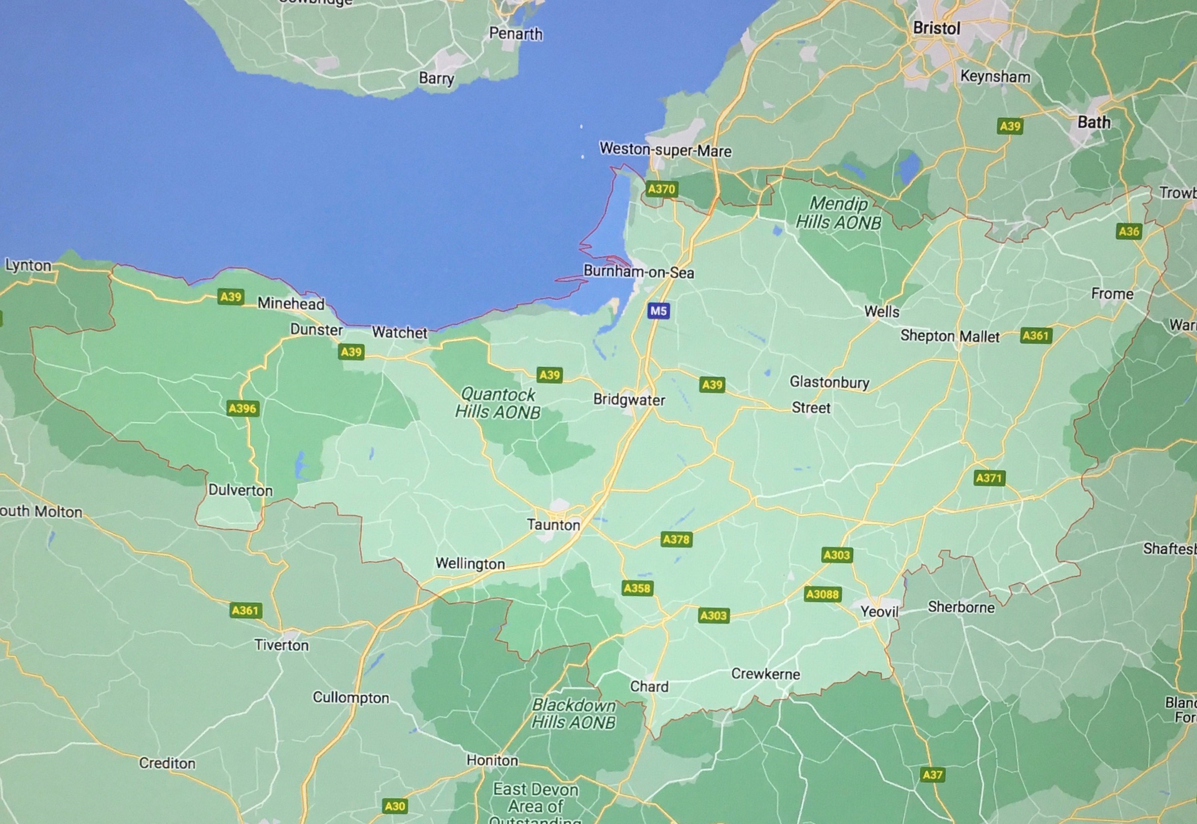
Well-Known Locales. Professor Taylor notes, “Two famous cities attracted strangers. Bristol, adopted home of John Cabot, and famous for its unique underground sewers removing ‘all noysome filth and uncleanness,’ was a city of merchants. Bath, a few miles away, was a city of healing.” Both are cited in Somersetshire, both in Speed’s Atlas and Taylor’s commentary.
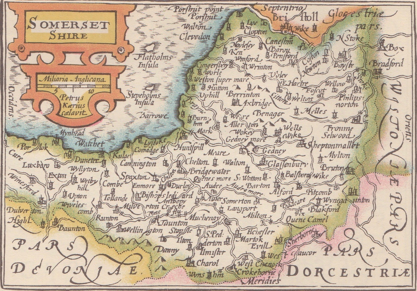
Long S Shape. We’re attracted by the traditional long s, ſ, which looks like an f with only half its crossbar. There are rules galore as to its usage.
Shire Borders. Note that there have been differences of borders among British shires, some historical, some administrative, some still being contested, as evidenced by CountyWatch, the Wikipedia entry of which is noted as having “multiple issues.”
Briſtoll is one evident example in the 1627 map; so is Glaſſenbury, today’s Glastonbury, in central Somerset. Less recognizable is the map’s Bayſte, Bath, and Fronme, Frome. As Professor Taylor noted, “The frequent mis-spelling of names is a blemish, but one only to be expected from foreign workers.” As cited in Part 1, Speed’s Atlas was the product of publishers and cartographers in Amsterdam.
Nunney Court. Rob and Betty Walker lived in Nunney Court, just southeast of Frome. On John Leland’s 16th-century shire survey, he likely made note of Nunney Castle, built in the late 1300s by Sir John Delamere. However, he apparently didn’t have room for the village in his sketch-map of Somerset.
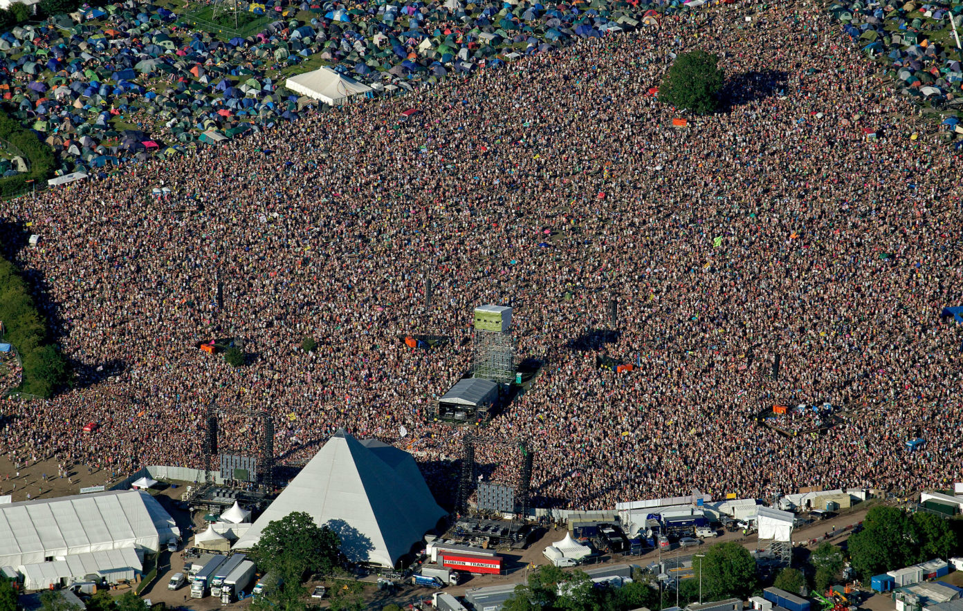
Glasto. Leland included Glaſſonbury, though, which today is associated with a music festival that makes Woodstock look like a few kids getting together to jam. Glasto, as it’s known, is the largest greenfield music and performing arts festival in the world, with a record of some 300,000 attendees in 1994.
Mystical Too. “What Makes Glastonbury So Mystical?” Simon Ingram poses this question in nationalgeographic.co.uk, June 27, 2019. He cites King Arthur, Avalon, Christ, the Grail, ley lines, paganism, and a submerged village.
Roberta Gilchrist, Professor of Archaeology at the University of Reading, is quoted: “Right up until the later middle ages Glastonbury was a very watery place, essentially an island. There was Glastonbury Tor, this outcrop that emerged out of the water, [then] further emphasised by a church on the top… It created an evocative landscape that attracted myths and legends from its earliest history. But because of the presence of monasteries and churches from as early as the 6th century, it became a sacred landscape, too.”
Joseph of Arimathea. Wikipedia describes, “Joseph of Arimathea was, according to all four canonical gospels, the man who assumed responsibility for the burial of Jesus after his crucifixion.” Joseph was wealthy, possibly a secret disciple of Jesus, possibly a metals merchant who visited the Roman outpost of Provincia Britannia.
In his National Geographic piece, Simon Ingram writes, “Entrusted with Christ’s burial, Joseph of Arimathea is variously said to have either sent the Holy Grail back to Britain with his followers, or brought it personally in his role as a missionary. In the latter case, he is found resting on the summit of Wearyall Hill, where he planted his staff—later sprouting into a miraculously flowering hawthorn.”
I’m reminded of a similarly sprouting staff in Wagner’s Tannhäuser.
Arthur’s Resting Place; Guinevere’s As Well. Ingram notes, “One of the more potent reasons modern Glastonbury remains one of the strongholds of Arthurian legend is that Glastonbury Abbey not only claimed to be the home of Arthur’s final resting place: it claimed to have the bones to prove it.”

Ingram continues: “Recounted in detail by Gerald of Wales in his De instructione principis (1193), a grave containing King Arthur’s sword-chipped, giant-like skeleton and that of his queen, Guinevere, was discovered by monks in 1191 buried between two stone pyramids. These were re-interred in a marble tomb in the church, which according to a sign today marking the spot, ‘survived until the dissolution of the Abbey in 1539.’ The abbey was destroyed, and the bones lost.”
Which brings us full circle to Henry VIII and Antiquary John Leland sketching maps on his quest. ds
© Dennis Simanaitis, SimanaitisSays.com, 2022
