
Simanaitis Says
On cars, old, new and future; science & technology; vintage airplanes, computer flight simulation of them; Sherlockiana; our English language; travel; and other stuff
TOURING TUDOR ENGLAND—WITH PROFESSOR EVA TAYLOR AND GOOGLE MAPS PART 1
LET’S OPEN WITH a timeline: Around 1540, King Henry VIII commanded Library Keeper and Antiquary John Leland to ride horseback throughout the realm to recover books and manuscripts scattered, stolen, lost or destroyed by dissolution of the monasteries.
Pause here to reflect that it was Henry VIII who had ordered this dissolution in the first place.
In performing his duties, Leland also assembled topographical information and sketched detailed maps of the kingdom’s shires. What with one thing and another (he subsequently became mentally deranged), Leland never published any of this.
In 1598, John Speed, a tailor by trade and antiquary by inclination, queried Queen Elizabeth about publishing Leland’s work. She turned him down.
During the next two decades, an Amsterdam family of publishers and cartographers bought into the project, with large maps evolving from Leland’s sketches published in folio in 1611. What’s more, handy pocket editions were all the rage, and in 1627 John Speed’s Pocket Atlas appeared.
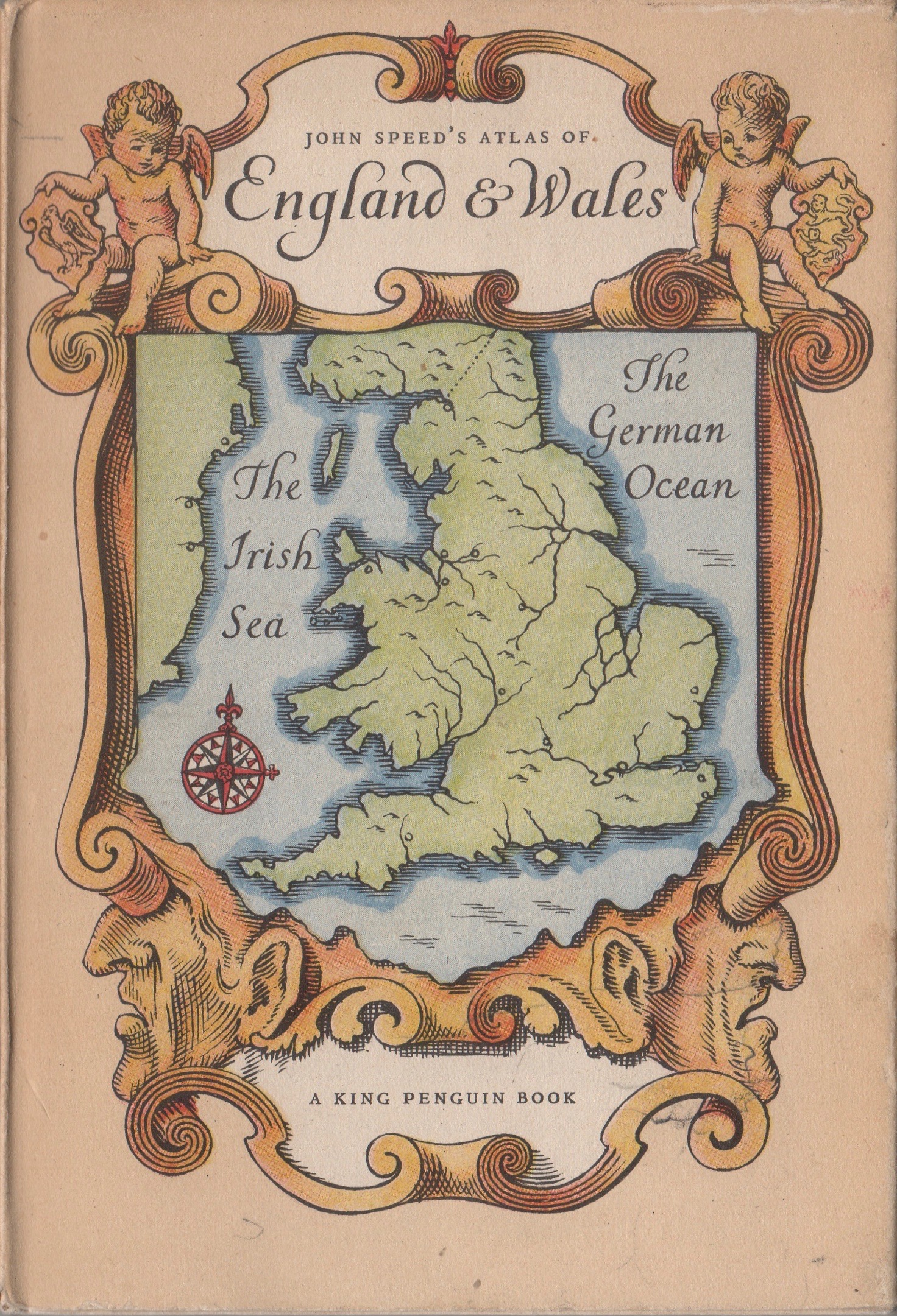
Fast forward to 1951. Professor Eva Taylor of Birkbeck College London University, the foremost authority on Tudor geography, arranged a facsimile publication and provided commentary on Forty Plates from John Speed’s Pocket Atlas of 1627.
Professor Emeritus Taylor, 1879–1966, was the first female professor of geography in the U.K., published prolifically, and was also renowned for her unconventional use of a walking stick: An academia.edu bio describes how “she used to point it at students when asking a question, as well as using it to hail taxies or even to hook Professor Darby’s leg to join her taxi from a crowd of people waiting.”
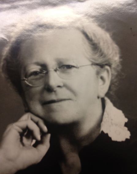
“Her writings were characterized by the extensive use of original sources and documentary evidence and they were always a delight to read.” This included “her two monumental volumes of the mathematical practitioners of Tudor and Stuart England (1954), and then those of Hanoverian England (1966)….”
Yes, quite the woman.
Fast Forward to a Denver Bookshop 1986. I acquired a bright copy of the King Penguin Book edition of John Speed’s Atlas of England and Wales. And one more jump to 2022 when I rediscovered the book and started correlating its maps and commentary with the help of Google Maps.
Here in Parts 1 and 2 today and tomorrow are tidbits gleaned from the efforts of John Leland, John Speed, and Professor Taylor, together with reminiscences of my own adventures in England and Wales.
Tudor Transportation. Professor Taylor observed, “A man on horseback moved more easily about Tudor England than is sometimes supposed, for it was heavy waggon and coach traffic (which had hardly begun) that cut up the roads…. Heavy or bulky goods, such as timber, stone, coal, grain, mail, hay, and straw, reached the larger towns by water—indeed, a town that lacked water-carriage could scarcely become important.”
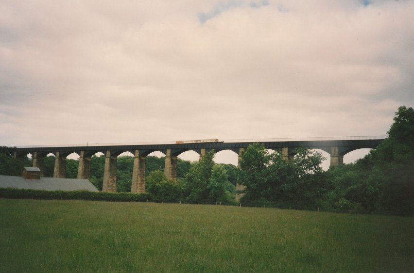
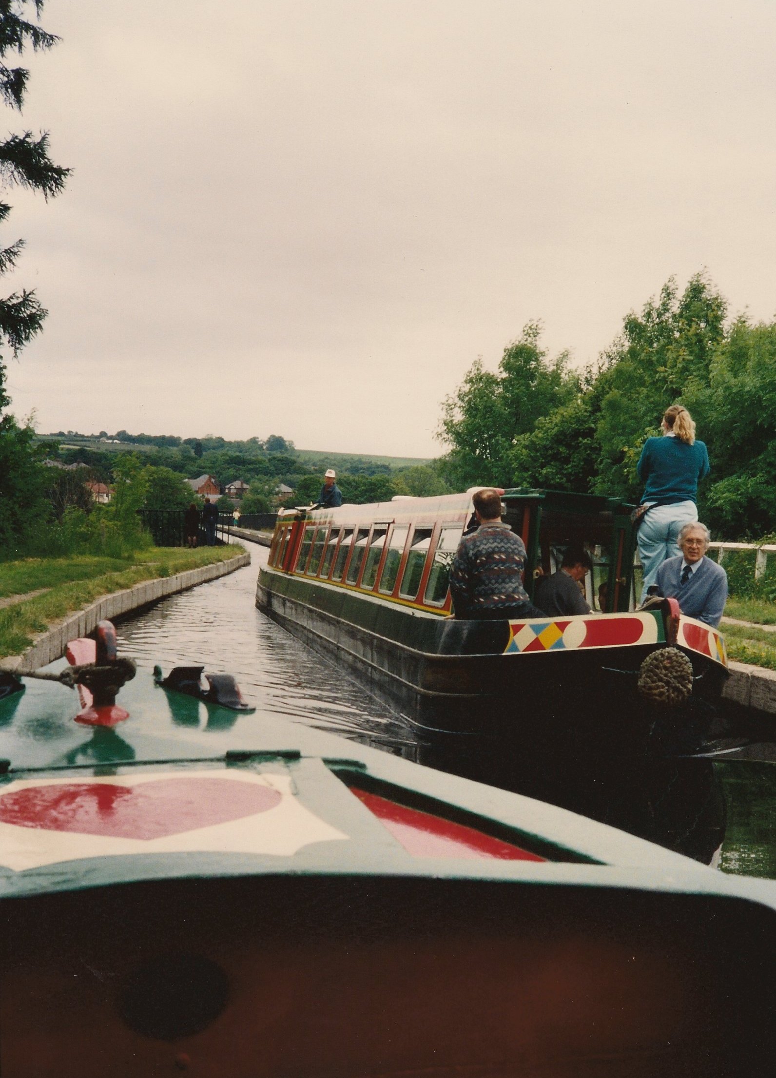
My own travels were typically by car, though I had a sample of water-borne transportation on the Welsh Llongollen Canal.
Wales. “The English castles,” Taylor noted, “planted strategically throughout Wales had for the most part been left to decay before Leland’s day…. But change was at hand. Here, too, the shadow of the Industrial Revolution crept forward over the countryside.”
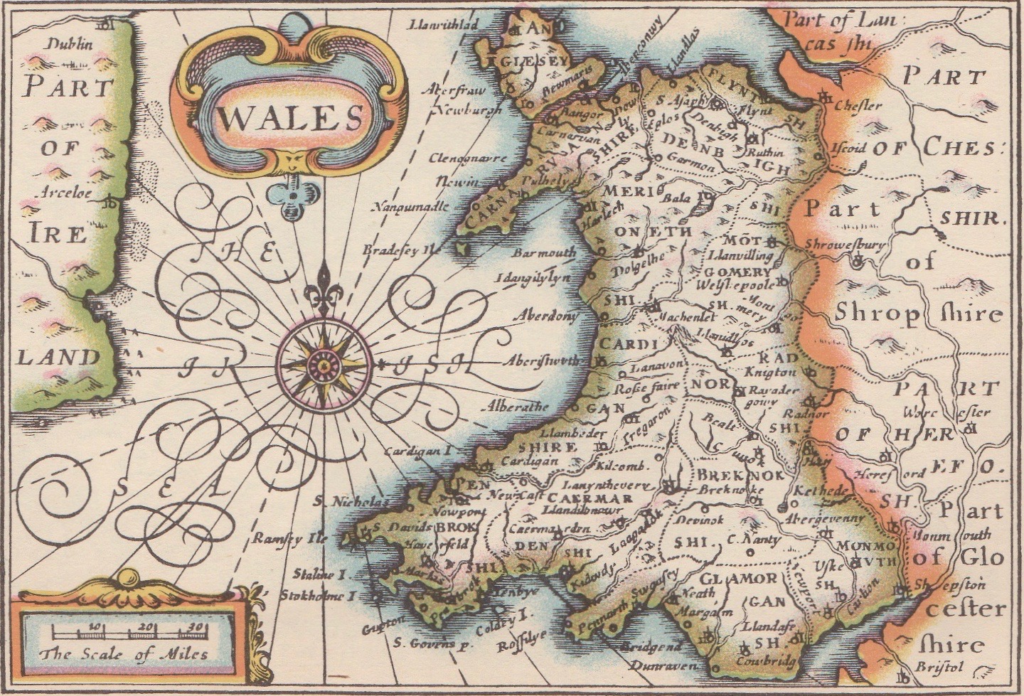

The Welsh double L is evident in several towns, Llanvilling, for instance, in the north. Though not shown on the Tudor map, but about halfway between Llanvilling and Ruthin lies Llangollen (my nearest pronunciation, “thl’an-gothl’n”). Wife Dottie and I rode a narrow boat along the Llangollen Canal, its Pontcysyllte Aqueduct built in 1805.
Tomorrow in Part 2, we’ll travel to Somerset with memories of Rob and Betty Walker, Joseph of Arimathea, and Glastonbury. ds
© Dennis Simanaitis, SimanaitisSays.com, 2022
