
Simanaitis Says
On cars, old, new and future; science & technology; vintage airplanes, computer flight simulation of them; Sherlockiana; our English language; travel; and other stuff
“ROUND ATLAS” FUN
I ONCE KNEW A YOUNG LADY, perfectly accomplished in other ways, who called globes “round atlases.” This popped into mind recently when I came upon several neat geographical tidbits, including the easternmost and westernmost places in the U.S. Not just the States, mind, but in the broadest sense of the territorial U.S.
Udall Points. Curiously, each is named Udall Point. The easternmost is Udall Point, St. Croix, U.S. Virgin Islands; the westernmost, Udall Point, Guam. Even more curiously, they’re named after two different Udalls, brothers Stewart and Morris, respectively.
Udall Point, St. Croix, U.S. Virgin Islands. This Udall Point is on the eastern tip of St. Croix, named in 1969 for Stewart Udall, U.S. Secretary of the Interior under Presidents John F. Kennedy and Lyndon Johnson. As part of a New Year’s celebration in 2000, a Millennium Monument sundial was erected there.

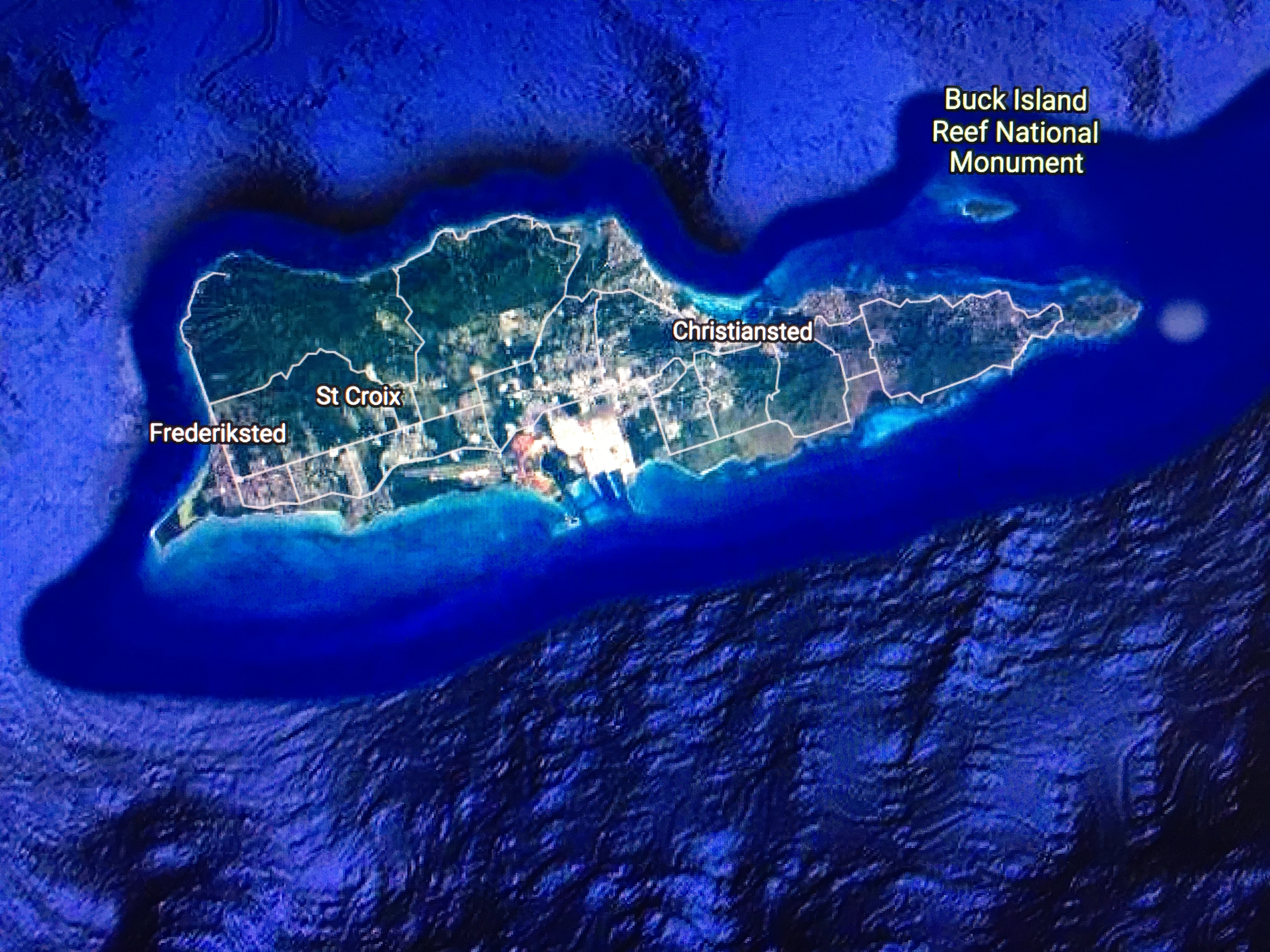
Stewart Udall served Arizona’s 2nd district in the U.S. House of Representatives from 1955 to 1961. JFK named him Secretary of the Interior in 1961, a position he held through the Johnson administration to January 20, 1969.
Udall Point, Guam. This Udall Point is on the Orote Peninsula of Guam, at the mouth of Apra Harbor. It used to be called Orote Point until renamed in May 1987 “to honor the service and accomplishments of Morris Udall.”
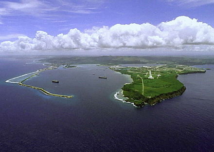

Morris Udall succeeded his brother Stewart as Congressman for Arizona’s 2nd district when the latter was appointed Secretary of the Interior.

What About the States? As noted awhile back in “On Straits and Narrows Part 2,” Alaska offers all sorts of geographical extremes: It’s obviously the northernmost and westernmost State. Any “round atlas” will confirm this.
But, curiously, Alaska is also the easternmost State: Semisopochnoi Island is part of the Rat Islands group in the western Aleutian Islands of Alaska. Wikipedia notes, “At 179°46′ East (+179.7667) (in the Eastern Hemisphere), the easternmost tip of Semisopochnoi is, by longitude, the easternmost land location in the United States and North America. Semisopochnoi sits only 14 minutes (0.2333 degrees) or 9.7 miles (15.6 km) west of the 180th meridian.”
Semisopochnoi is uninhabited; nor does it have any native land mammals. Supporting well over a million seabirds, it’s considered an important nesting area.
Other “Round Atlas” Oddities—At Least to Me. I’m always a little surprised to see Miami (at 80.1918º W) farther west than Buffalo (78.8784º W). And Reno (119.8143º W) farther west of my Orange County, California, digs (117.8677º W).
But then there was a time when I thought the summer sun set in the north. See “The Harley Guys and the Ramjet Part 2” for a justification of this mental aberration, sorta. ds
© Dennis Simanaitis, SimanaitisSays.com, 2022

The southernmost point in Canada, Middle Island, Ontario, located in Lake Erie, is further south than Crescent City, CA.
Ha. Another good one (along with Detroit’s northernly location).
Yes, I always thought that Detroit was west of Windsor, ON, but of course as you noted, it is located to the north.