
Simanaitis Says
On cars, old, new and future; science & technology; vintage airplanes, computer flight simulation of them; Sherlockiana; our English language; travel; and other stuff
NEW ENGLAND 1915
UNLIKE SOME places, New England has few signs that read “Fine dining since 1993.” Things in the northeast corner of the U.S. have a permanence that encourages perusal of old guidebooks.

The favorite motor ways of New England: Historical and descriptive : with illustrations, comprehensive road maps, and sky-line sketches (MacNair’s motorway series) by L.H. Baker, Henry MacNair Publishing, 1915.
My favorite is titled, coincidentally enough, The Favorite Motorways of New England. This guide is approaching a century old, yet its information rings with authenticity. (I’d double-check any hotel rates, however.)

Cotton Mather, 1663 – 1728, New England Puritan minister, author and pamphleteer.
Author Baker’s Preface is particularly self-effacing in quoting a famed New Englander, Cotton Mather, with regard to the rarity of books without errata: “It seems the hands of Briareus and the eyes of Argus will not prevent them.”
Being as I am mythically challenged, I had to look these two guys up. They’re both Greek gods. Briareus had 100 arms; Argus, 100 eyes.
The guide offers 15 detailed routes. The first, “The Main Entrance,” starts from New York City and passes through New Haven, Connecticut, to Springfield, Massachusetts. Others are more New England specific, “Through the Narragansett Country to Boston,” for instance.
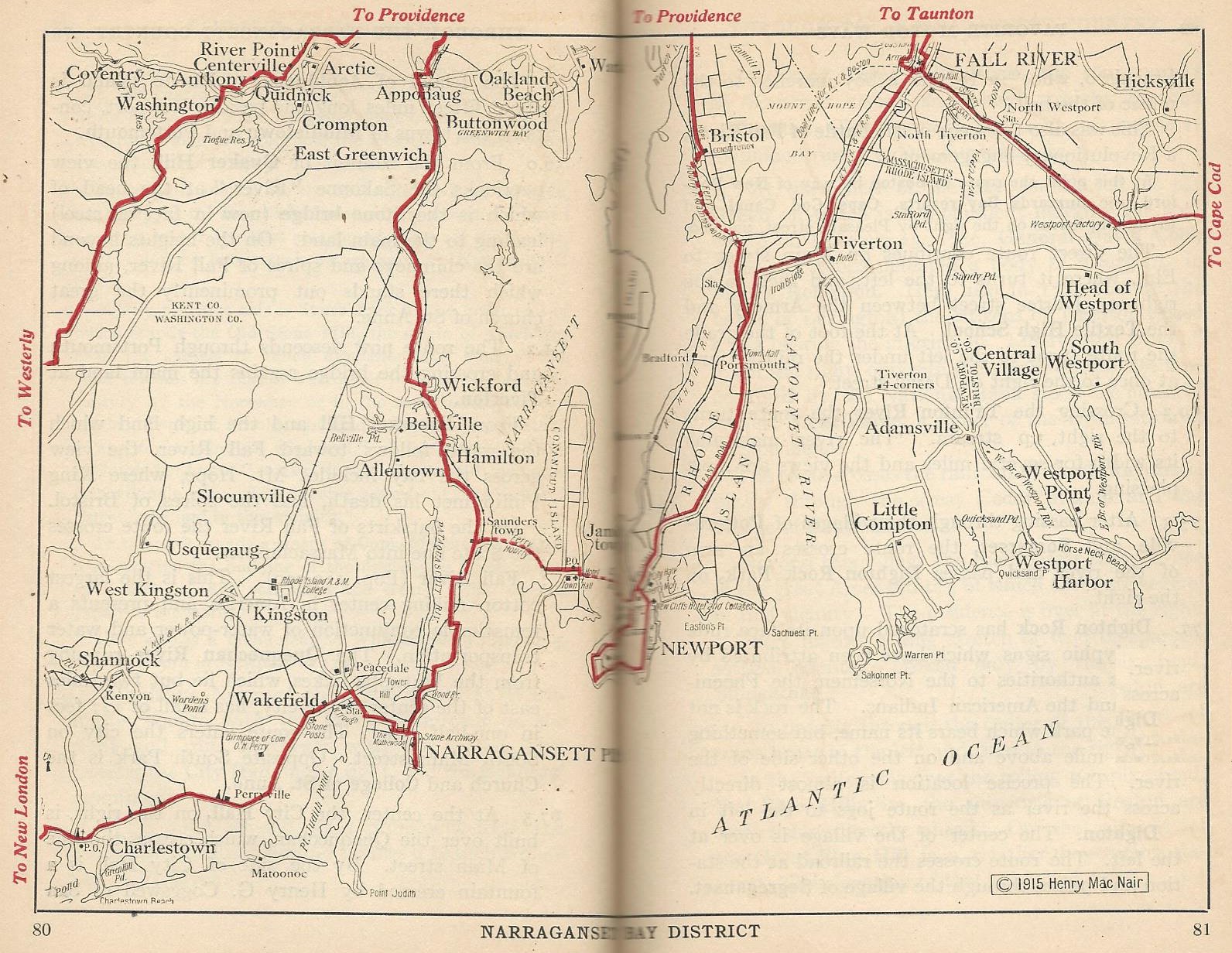
Narragansett Bay District. This and other images from The Favorite Motorways of New England.
According to the guide, “The section traversed by this route is noted historically as having been the home of the Indian tribes which caused more trouble to the colonists than any others in New England.” So much for Thanksgiving lore.
The route to the northeast goes through Fall River, Massachusett. The town is cited as “the largest cotton milling center in America and presents a remarkable conjunction of water-power and water transportation.” No mention is made of the happenings in Fall River occurring only 23 years before. See “Lizzie Borden Took an Axe—Or Did She?” (http://wp.me/p2ETap-1VD).
Entering the Boston metropolitan area, there’s plenty of sightseeing to be had. “On the right at the second crossing of Brookline avenue is Miss Wheelock’s School for kindergarten teachers. The medallion over the entrance represents Froebel instructing a group of children whose faces are those of children of graduates of the school.” (No doubt, this refers to Friedrich Froebel, 1782 – 1852, German pedagogue.)
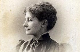
Lucy Wheelock, 1857 – 1946, educator, founder of what became Wheelock College.
In 1939, Miss Wheelock’s institution became Wheelock College; in 2012, it offered online courses in improving science and mathematics education for elementary students.
The guide has three fine-print pages of hotels and inns on or near each route. Ten are listed for Boston, including the Copley Plaza, “500 rooms, all bath, singles $3 – $5, doubles $5 – $7.”

Above, Boston’s Copley Plaza Hotel as it appeared in 1915. Below, as it appears today (http://goo.gl/8kaN0N).

“Among the Mountains” offers a tour along New Hampshire’s Presidential Range. In 1915, prominent peaks included Mts. Washington, Jefferson, Adams and Monroe. (There’s now a Mt. Eisenhower too, known as Mt. Pleasant in 1915.)

Above, the Presidential Range, as identified from Bretton Woods, New Hampshire, 1915. Below, the Mt. Washington Hotel at the foot of the range.
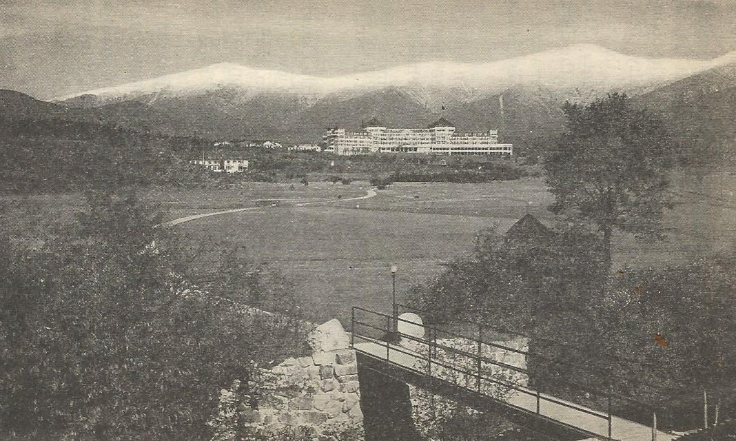
The guide recognizes the Mount Washington, in Bretton Woods, New Hampshire, as “the largest and finest resort hotel of New England.” Open July 8 – October 15 in 1915, its 550 rooms were $7, $8 with bath. The Mount Washington Resort continues this reputation (http://goo.gl/RrdYbe), though not at the same rate.
Already highly regarded in 1915, Bretton Woods and its hotel made history in 1944 as the venue for the United Nations Monetary and Financial Conference which led to establishment of the World Bank and International Monetary Fund.
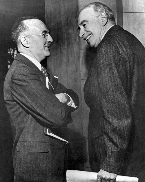
Harry Dexter White, left, represented the U.S. at the Bretton Woods Conference; John Maynard Keynes represented Great Britain.
Did you know that economist John Maynard Keynes was 6 ft. 6 in. tall? This fact wasn’t in The Favorite Motorways of New England, but it was this guidebook that encouraged me to look it up. ds
© Dennis Simanaitis, SimanaitisSays.com, 2014

A “new” ROUTE BOOK FOR ELECTRIC VEHICLE TOURS, found in Highway Transportation, official mag. of the Motor Truck Association of America, Feb, 1922:
“A handbook showing automobile routes and charging stations for electric vehicles has just been issued by the Automobile Bureau of the Net York Edison Company. [ ]
“Two maps are included. One shows the location of all the charging stations in New York City, and the other shows the routes and garage facilities for electric vehicle tours. The increasing touring capacity of the electric is indicated by this map as it covers routes as far north as Pittsfield, Mass., as Far East as New Haven, Conn. and southampton, Long Island, as far west as Delaware Water Gap, and as far south as Atlantic City.