
Simanaitis Says
On cars, old, new and future; science & technology; vintage airplanes, computer flight simulation of them; Sherlockiana; our English language; travel; and other stuff
TRIPPIN’ THRU TIME IN LONDON
DAUGHTER SUZ SHARED “In London, Looking Backward to Move Forward,” by Henry Wismayer in The Washington Post, March 4, 2021. In particular, she recommended its link to Layers of London, an online collection of maps to one of my favorite cities. Here are tidbits of my first time-trippin’ with this fascinating interactive website, together with my usual Internet sleuthing.

The website’s “Getting Started” shows how layers of historical maps can be constructed around particular themes, in this case St. Paul’s Cathedral.
St. Paul’s. Actually, there have been religious edifices on its central London site since perhaps 604 A.D. The first map in my layer locates Old St. Paul’s, begun by the Normans after a fire destroyed an earlier church in 1087. This “new” church wasn’t completed until 1314.
Henry VIII’s nationalization of matters religious culminating in 1540 didn’t help Old St. Paul’s upkeep. However, it is a prominent element located in Layer of London’s reconstruction of a 1520 map.
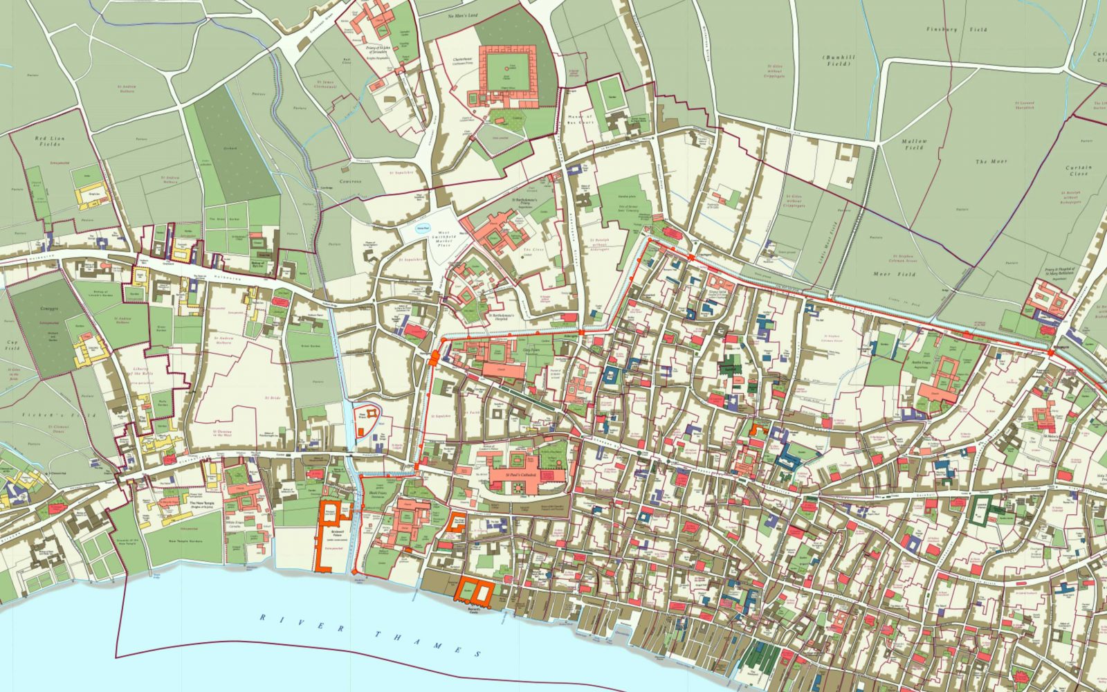
Old St. Paul’s is evident as the large cross-shaped building. Note the density of London to its east and down to the River Thames. The major artery heading west of St. Paul’s is Ludgate Hill, which turns into Fleet Street and, farther west, into The Strand extending to Charing Cross, this last locale not in this map’s coverage.
Old St. Paul’s was all but destroyed in the Great Fire of London in 1666. Christopher Wren designed the “modern” St. Paul’s, ground broken in 1675, consecrated in 1697.
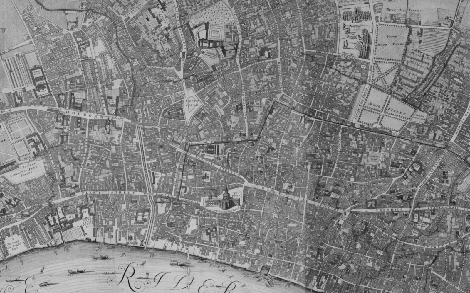
The St. Paul’s shown in William Morgan’s 1682 City of London is evidently Wren’s design, not the earlier spired Old St. Paul’s. Morgan’s map clearly shows the Fleet Street/The Strand split to the west, north of which is Lincolns Inne Fields, established in 1630s and the largest public square in London to this day.
London Poverty. Charles James Booth, 1840–1916, was a British shipowner, social researcher, and reformer. His Poverty Map of London, 1898-1899, is color-keyed to indicate the incomes and social classes of its inhabitants.
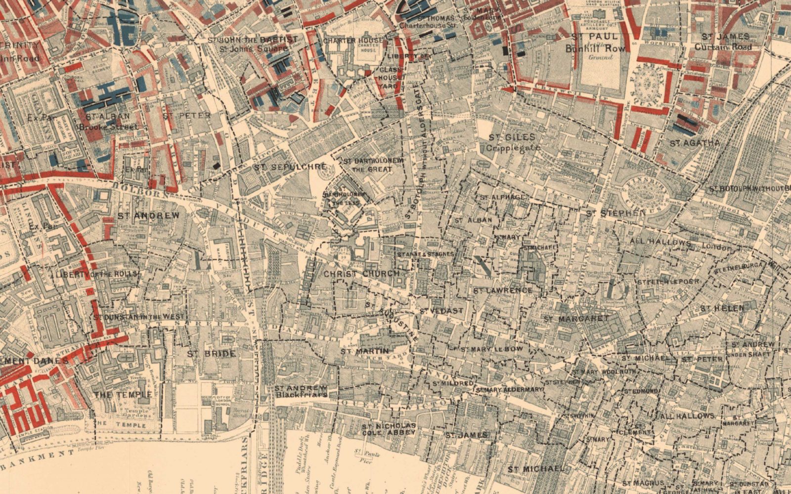
The Booth Poverty Map of London from 1898-1899.
Rare pockets of gold in Booth’s map indicate “Upper-middle and upper classes;” red, “Middle class;” rose, “Fairly comfortable.” The darker portions ranging from mottled blue, “Poor;” to blue, “Very poor, chronic want;” to black, “Vicious, semi-criminal.”
Needless to say, a lot had happened to London since 1682. For example, to the southeast of St. Paul’s is Blackfriar’s Bridge across the Thames, originally built in 1769 and rebuilt a hundred years later. (The earliest London Bridge dated from 50 A.D.; the one built in 1831 is now reconstructed in Lake Havasu City, Arizona. Neither has anything to do with London’s Tower Bridge, the one with the lifting portion, inaugurated in 1894.)
The Blitz. Much of London was damaged when the Nazis waged a bombing campaign against Britain in 1940–1941. An iconic photo shows St. Paul’s amidst the destruction.
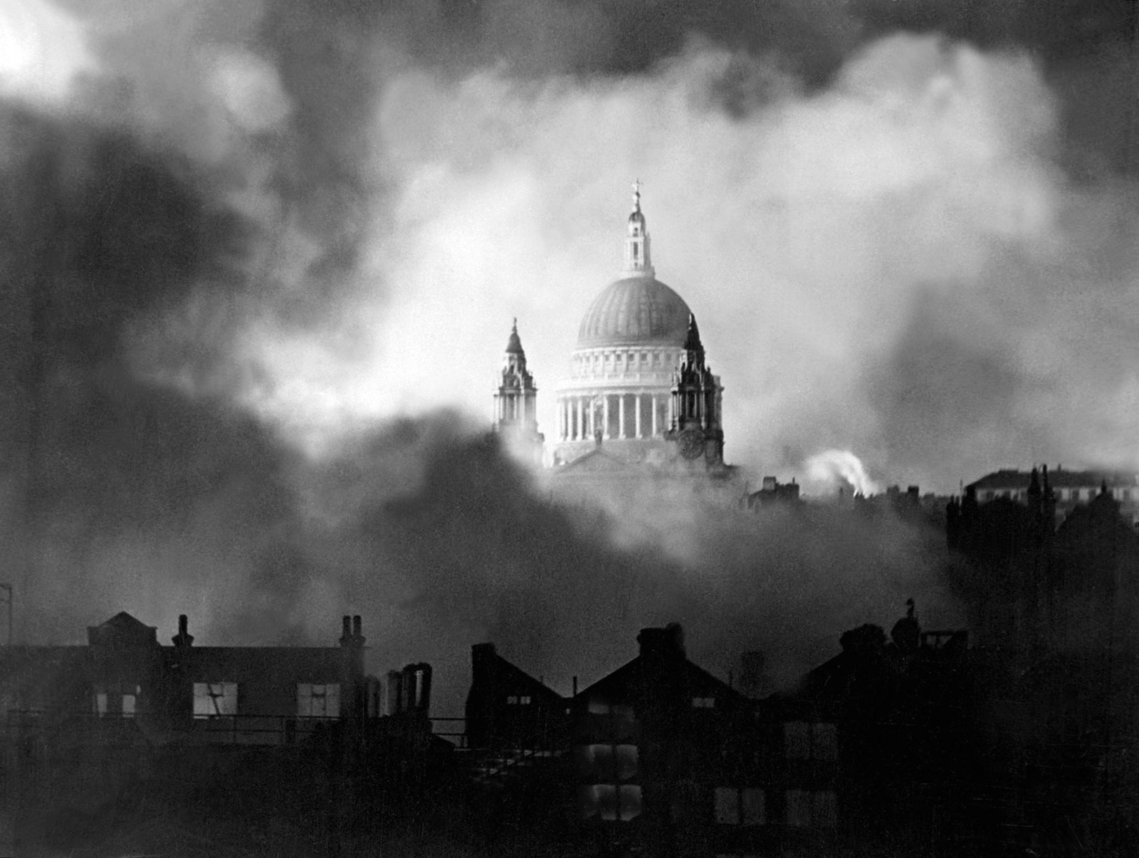
Henry Wismayer’s Washington Post article introducing me to Layers of London describes the terror caused by the Blitz. He makes a particularly cogent point: “It just becomes that much harder to bemoan the hardship of wearing a mask in a supermarket when you think of your forebears going to bed each night for a year, waiting for the sirens.”

Google Maps. As a concluding point, I note how my Layers of London time-trippin’ is enhanced by Google Maps. I verified locales with Google‘s London, centered at St. Paul’s Cathedral. ds
© Dennis Simanaitis, SimanaitisSays.com, 2021

And of course the City of London (as opposed to the Greater London Metropolitan area) is just over a square mile with a population of 9401 (2016).