
Simanaitis Says
On cars, old, new and future; science & technology; vintage airplanes, computer flight simulation of them; Sherlockiana; our English language; travel; and other stuff
WHICH WAY IS NORTH? AND WHY ANYWAY? PART 2
YESTERDAY IN PART 1, WE BEGAN SHARING James Vincent’s London Review of Books assessment of Jerry Brotton’s Four Points of the Compass: The Unexpected History of Direction. Here in Part 2, ecclesiastical architecture enters the discussion and so do Polaris and the digital blue dot “You.”
Architectural Controversies. Vincent describes, “Early Christian churches were built so that the altar, congregation and priest faced ad orientem (literally, towards sunrise), a decision that was eventually a focus of theological controversy.”

An early Christian church plan. Image from Wikipedia.
“During the Reformation,” Vincent recounts, “the Church of England placed altars in the north of the church or had the priest stand at the north end of the communion table instead of facing east.”

Recent episodes of “Wolf Hall: The Mirror and the Light” suggest Henry VIII’s serial matrimony bringing him into conflicts with Pope Clement VII.
A Long-Standing Squabble. Much later Vincent relates, “In the 19th century, the Oxford Movement began to worship ad orientem once more as part of a broader effort to reclaim the Catholic heritage of Anglicanism. The issue even reached Parliament, Brotton notes, when ad orientem services were banned by the Public Worship Regulation Act of 1874 along with other elements derided as ‘ritualism.’ (The Act was repealed in 1965.)”
Most recently, Vincent notes, “As Pope Benedict XVI wrote in 2000, ‘praying towards the east is a tradition that goes back to the beginning. Moreover, it is a fundamental expression of the Christian synthesis of cosmos and history.’ ”
How Come North is Up? “Given the power of the east-west axis,” Vincent says, “it may seem surprising that the eastward orientation of the world was ever displaced, yet it was, on maps at least. Brotton identifies a number of reasons north became primus inter pares of the four cardinal directions. It starts with Greco-Roman culture, in particular the cartography of the Alexandrian scholar Ptolemy, who knew the world was a globe and thought the best way to project it was as a grid. On such a map, the vertical lines of longitude converge naturally at two poles (the choice to put north on top seems to have been purely a matter of custom).”
Polaris: the Ship-Star. Vincent continues, “In the northern hemisphere, Polaris, the North Star, also aided navigation before compasses. For Anglo-Saxon navigators, Polaris was known as the scip-steorra, or ship-star, and became associated with the Virgin Mary in her role as mankind’s guide in the journey towards Christ – she was Stella Maris, ‘Star of the Sea’. As the compass became crucial for trade, warfare and exploration, these antecedents led pilots and mapmakers to privilege north over south, and this orientation was cemented from the medieval period onwards by European colonisation and global trade.”
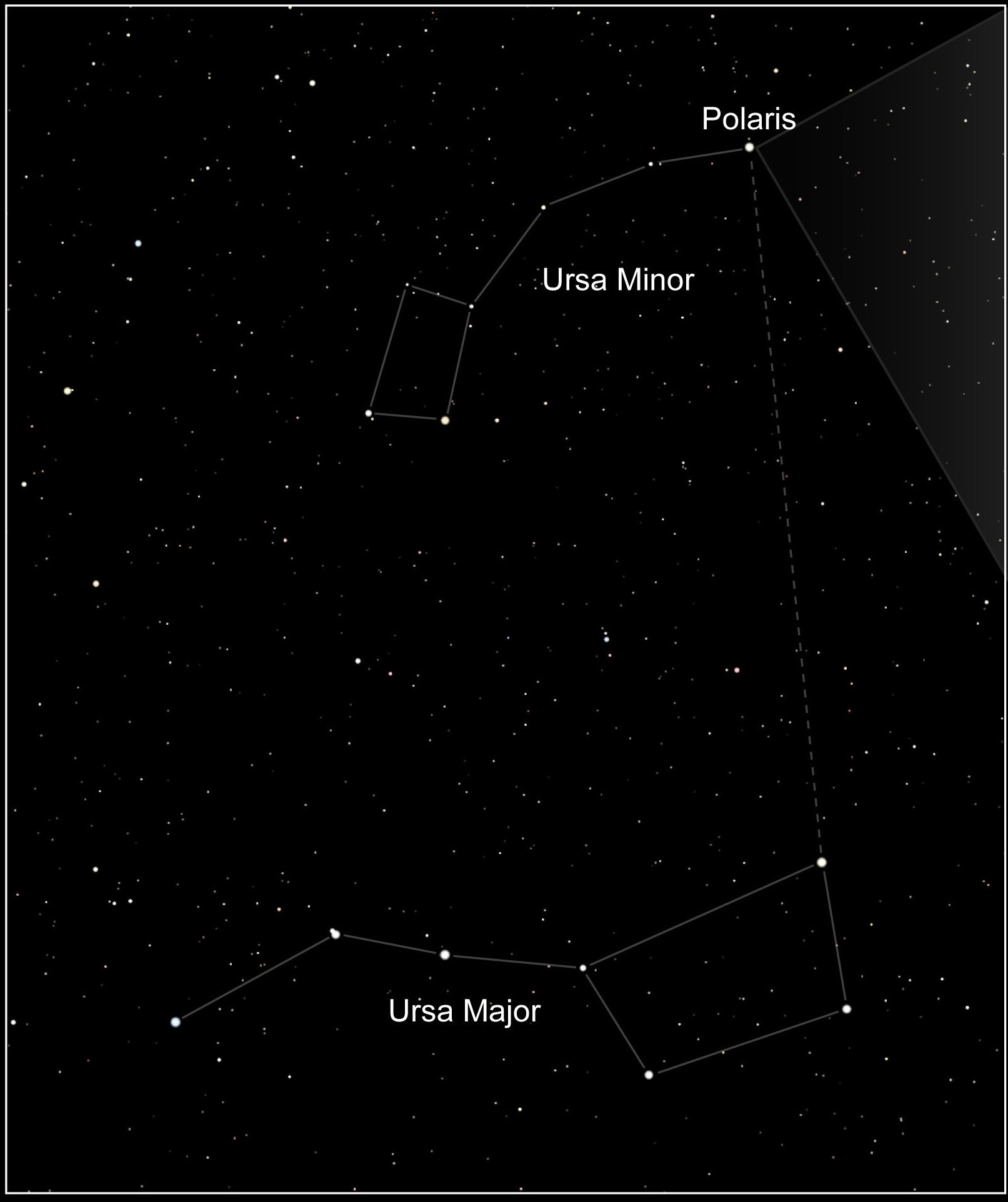
Polaris, the North Star. Image from NASA/HST via Wikipedia.
Today’s Digital World and “You.” Vincent posits, “Do the dense layers of meaning associated with each cardinal direction persist in the modern age? Brotton ends his survey by noting the year the reign of the compass finally expired: 2008, which saw the launch of the iPhone and the creation of the blue dot, the constant marker in map apps by which we now orient ourselves.”

Well, here You are. Image formed with the help of Google Maps.
“ ‘In this our digitised century,’ Brotton writes, ‘there are now five directions – north, south, east, west, and the online blue dot: “You.” ’ ”
© Dennis Simanaitis, SimanaitisSays.com, 2025

Ah, but the Blue Dot is placed on a map that is oriented, by default, with North at the top…
I’m surprised that the MAGATs haven’t demanded that the Blue dot be replaced by a Red one!